Good Friday afternoon everyone!
We are well entrenched in the pattern change I mentioned last week where the warm ups will be brief between cold fronts. Another cold front moved through yesterday which will set the stage for mostly tranquil weather through most of the weekend. Only Sunday will feature about a 20 percent chance of a shower but more than likely we get nothing.
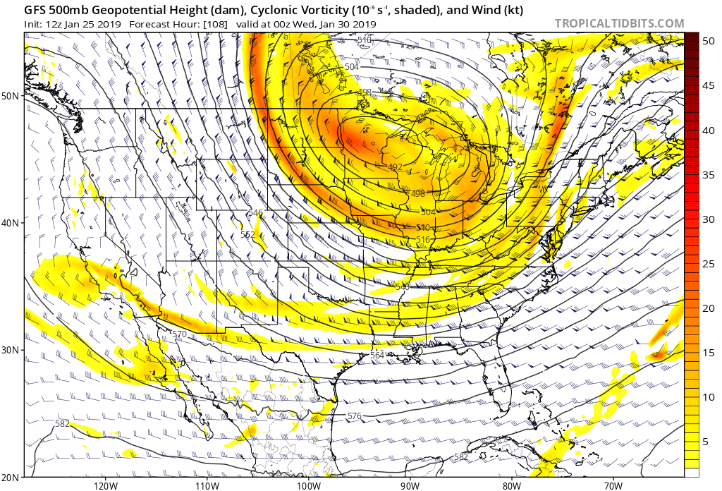
Next up will be some major cold air across the eastern half of the country. All indications are that the polar vortex will drop down into the Great Lakes area come Tuesday. The image I attached to this post shows the potential location of the vortex. Temps will be just absolutely bitter cold pretty much everywhere north of Tennessee. We will feel the effects also with two strong cold fronts but the bulk of the worst of the cold will remain to our north. It’s still going to be cold here Tuesday onward though for sure.
Now of note of interest is the cold front that will be moving through Tuesday morning. Normally with a cold front all the moisture is out along and ahead of it. In this situation the bulk of the precip should be behind the cold front. And since the air behind the front means business, there is a shot at the precip turning over to snow before it ends. This system is 4 days out so much will likely change but its within 5 days so in my world the system has entered into the area of what I call the Realm of Possibility. Remember my rule of thumb is anything 5 plus days out is called fantasy land so we are out of the phase. Now we have something to track. Some guidance says we are going to have a hey look at those flakes falling kind of event and some says more. This is way way too early to call so don’t believe anything you see out there right now that says we ARE GOING TO GET x number of inches. Nobody in their right mind should be stating this like that for us…at this point in time. If by Sunday afternoon I’m still tracking this system then we should have more specifics to talk about. Until then enjoy our continued below normal temps.
With that in mind here is the forecast…
Tonight…clear and cold with lows in the mid to upper 20s.
Saturday…high clouds increasing late with a high in the mid to upper 40s.
Sunday…mostly cloudy with a 20 percent chance of a shower and a high in the mid to upper 40s.
Monday…mostly sunny with a high in the mid 50s.
Monday night…increasing clouds with a low in the low 40s.
Tuesday…cloudy with rain possibly changing to snow showers. Turning windy with temps falling below freezing during the afternoon.
Wednesday…sunny and chilly with a low in the low 20s and a high in the upper 30s.
Thursday…cold with a low in the low teens and a high in the low to mid 30s.
Friday…sun though high clouds. Morning low in the low 20s and a high in the low 40s.
Thanks for reading!
Jason