Good Saturday morning everyone! We are on the eve of an overall pattern change. A strong cold front is going to blast through tonight (Saturday night) ushering in much colder air. Ahead of the front today we can expect rain that will be heavy at times and possibly a thunderstorm. I’m not expecting any severe weather. The winds could get quite gusty out of the south this afternoon especially if you live in higher elevations.
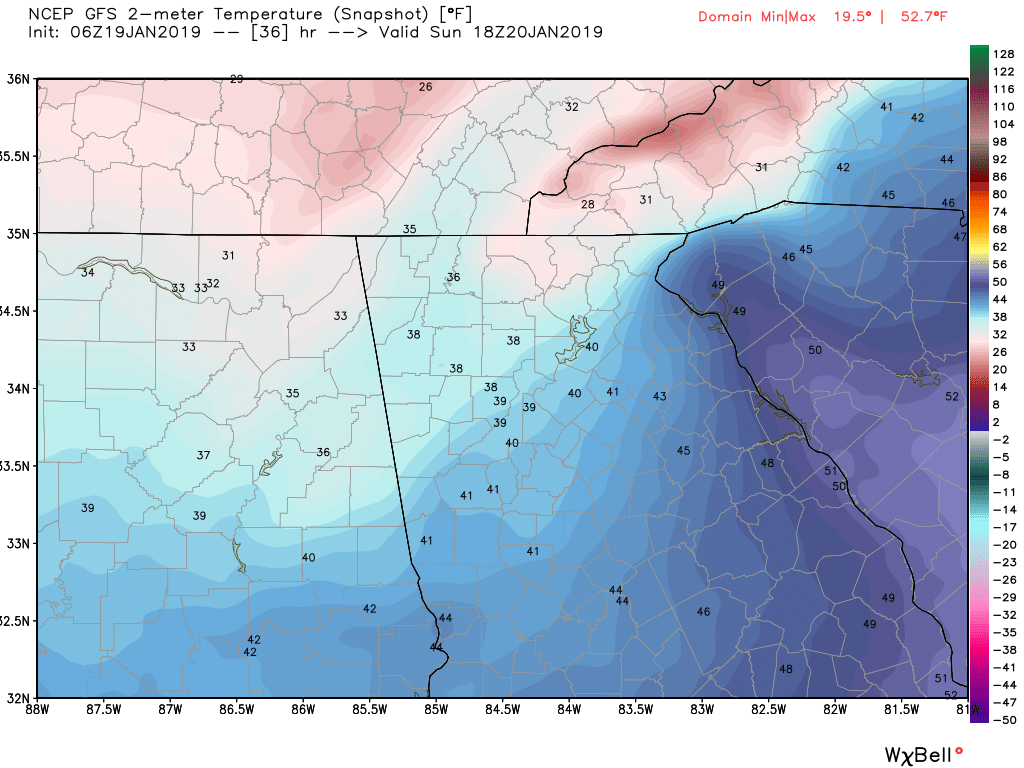
The front should pass the area sometime near or shortly after midnight putting an end to the rain. Behind the front on Sunday expect gusty winds and temps in the 30s pretty much all day long. The image attached to this post shows what it could look like at 1p tomorrow (Sunday). Brrrr……. There is a shot of a few scattered snow flurries with a dusting or so possible along and north of the spine of the apps. (Suches, Blairsville, etc).
Now this front will be the lead to an overall pattern change where we will see more frequent cold fronts as an overall ridge dominates out west while the trough sets up in the eastern half of the country. For Monday and Tuesday expect highs in the mid 40s with lows in the mid to upper 20s.
Another front is set to approach the area on Wednesday bringing warmer air ahead of it and more rain starting Tuesday night lasting into the Thursday AM hours.
That’s it for now and there are no legit snow threats to track but as we get deeper into this pattern that could change.
Thanks for reading!
Jason