Good Saturday evening everyone!
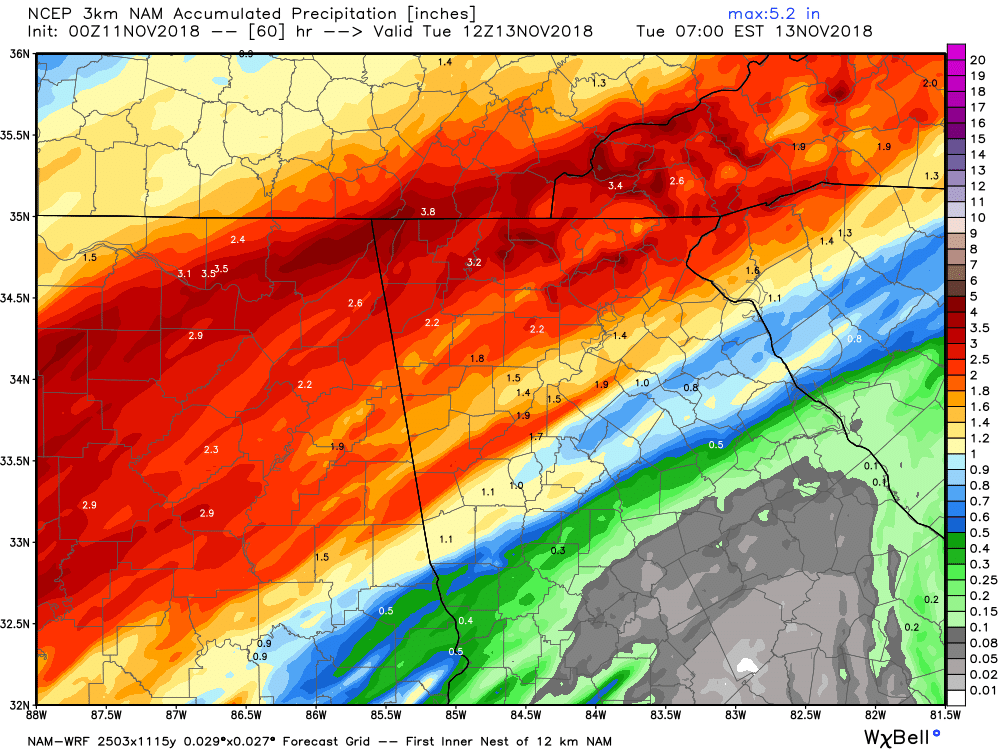
What a nice and crisp fall/winter day today as our high was only 49 which is more normal for January versus November. Our colder than normal pattern will through this week. Up next is an area of low pressure that’s going to develop in the Gulf and track NE up through the Carolinas. Rain will spread back into the area before sunrise Monday and last into at least the first half of Tuesday. Along with the rain on Monday will be a stiff east wind (wedge) holding temps near 40 if not upper 30s during the day. And lots of rain we will have as 1-3 inches should be the story across most of northern GA Monday into Tuesday. I’m not expecting any severe weather but rather just a cold, soaking rain.
With that in mind here are the details…
Sunday…increasing clouds late with a high near 50.
Sunday night…rain moving in towards sunrise. Low in the upper 30s.
Monday…chilly rain with a steady east wind breeze. Temps steady in the upper 30s to low 40s.
Monday night…rain with temps slowly rising into the mid to upper 40s.
Tuesday…rain possible through at least the first half of the day with a high in the low to mid 50s.
Tuesday night…mostly cloudy with a low in the low 40s.
Wednesday…partly to mostly cloudy with a high near 50.
Rain chances are possible again Thursday into Thursday night as another area of low pressure develops in the Gulf.
Thanks for reading!
Jason