Good Wednesday evening everyone!
Another week…another strong weather system. Once again an upper level low (common in the spring) will track across the southeast. As you probably felt today, the humidity went way up as our dewpoint climbed back into the low 60s. But this time the high humidity will be short lived as the upper level low will bring a pool of cool air with it especially on Saturday.
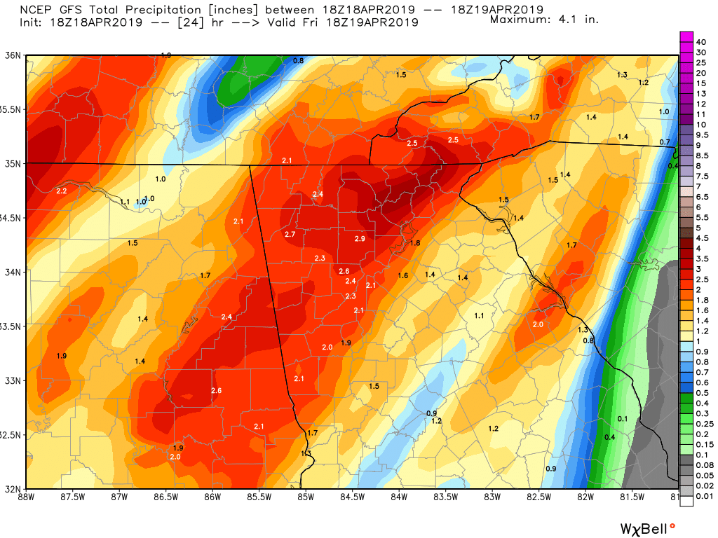
Now there have been talks of severe weather tonight. While conditions are not as favorable for any sort of tornado development they are more favorable for strong winds. A very strong low level jet stream, around 5,000 feet up, will be screaming across the area at 60+ mph in the early AM hours on Friday. When you combine strong winds like that aloft with a line of thunderstorms, then you are likely to see those storms transport some of those winds to the surface. So I’m expecting winds to gust to near 40 mph give or take during the 4a to 8a Friday time frame. And the rain should be very heavy at times during that same period. The image I posted is the GFS model estimated rainfall between now and 2pm Friday. Yep…1-2+ inches should be the story across the area with most of that falling between 4a and 8a Friday.
After the main line moves through in the early AM hours on Friday expect mostly cloudy skies with on and off showers and possibly another afternoon thunderstorm or hail producer as the cold core aloft starts to move across the area.
Now I also think there is the possibility of a few snow showers mixing in with the rain showers at elevations near or above 3000 feet come early AM Saturday. If some higher elevations got a dusting I would not be surprised. Again that is just for areas along and north of the spine of the mountains. Fret not though as we will warm back up super quick by Sunday.
Here are the details…
Tonight…heavy rain and storms with high winds likely after 4a tonight.
Friday…heavy rain moving off to our east during the AM hours then just mostly cloudy with on an off showers and possibly an afternoon hail producer. High in the mid 60s.
Saturday…mostly cloudy and breezy with scattered showers with snow showers possible above 3000 feet. High only in the upper 40s.
Sunday…sunny and warmer with a high near 70.
Monday…sunny with a high in the upper 70s.
Thanks for reading!
Jason