I know this wasn’t emphasized yesterday but it has become more apparent that a squall line is likely to develop in TN and move south across North Georgia late this afternoon. This is in response to a piece of upper level energy rounding the back side of the upper level trough.
Timing of arrival is somewhere in the 5-6pm range. Primary severe threat will be strong winds and possibly hail. This will need to be monitored closely because if it develops stronger then high winds could become more of a factor.
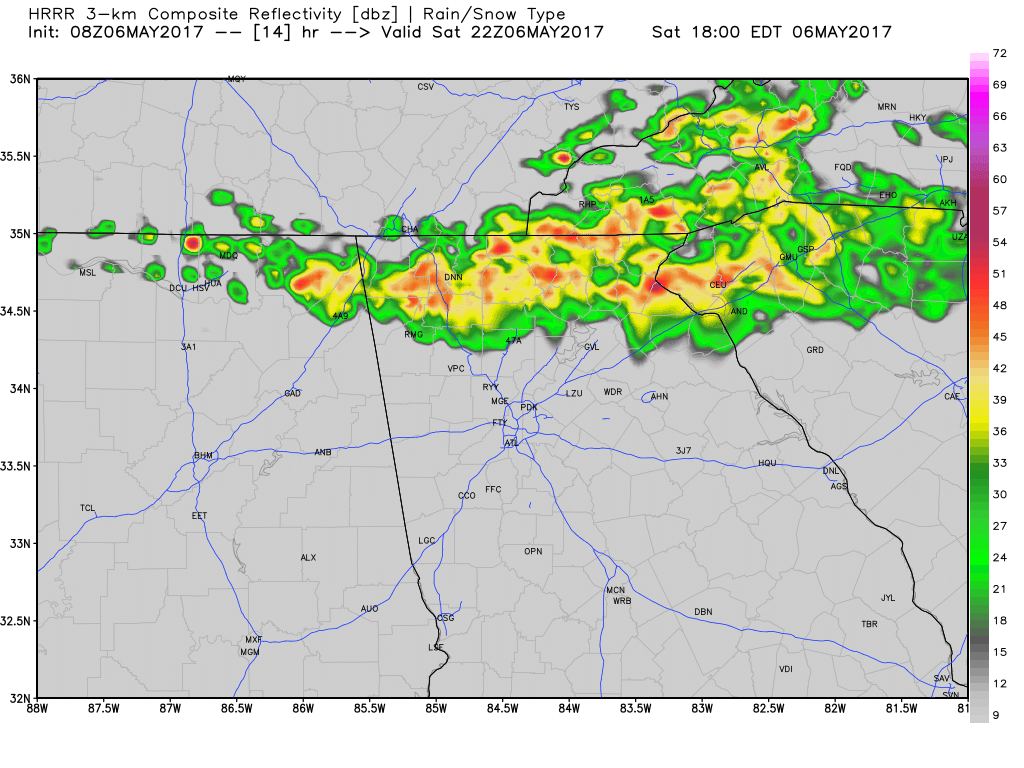
The image is what the radar could potentially look like towards 6pm today.
Oh no, Hillary Darty
O shoot!!! What do I do now!
Something inside 😀
Haha I might see about bumping it up soon people won’t be out in this weather!
Opps bumping the time up some so people won’t be out in the weather.
😐 of course, today is the 8th grade dance and that’s just the time all the kids will be in the square
Keep us posted!
Alvin Ely Self