Happy Friday everyone!
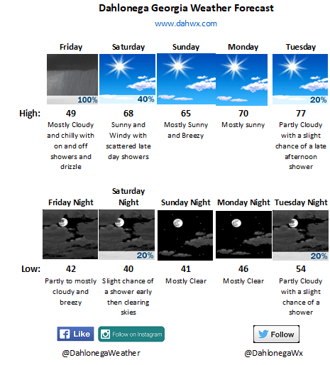
Chilly and raw will be the story of the day. So much so that we will tie our record cold high temp for May 5th. Our high for today has already happened and that was at 1202am at 54 degrees. As I type this at 920am it’s a balmy 46.9. Our high of 54 ties the record cold high for this date set back in 1967. Expect temps today be stuck in the upper 40s. Brrr… Also expect scattered showers and drizzle action to increase as we head through the afternoon.
But fear not, a warming trend is on the way. After today the next rain chance is late Saturday afternoon and then a small chance Tuesday afternoon.
Thanks for reading and enjoy our 25+ degrees below normal day!
Jason
Thank you!
So are you expecting tomorrow to be another record?
No ma’am. Today. 🙂
Did I mistype something?
So whats up w/ no wind advisory or even a mention on the gale force winds were experiencing overnight?
Wind Advisory was issues at 3am. I was asleep. Lol. But at least I forwarned it was going to be windy today. 🙂