There is a higher risk tornado watch for all areas just south of us. I will be watching things closely as everything develops later this afternoon.
URGENT - IMMEDIATE BROADCAST REQUESTED
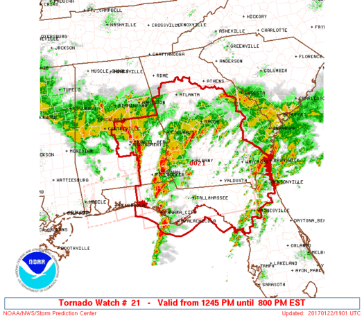
Tornado Watch Number 21
NWS Storm Prediction Center Norman OK
1245 PM EST Sun Jan 22 2017
The NWS Storm Prediction Center has issued a
* Tornado Watch for portions of
Southeast Alabama
North Florida
Central and Southern Georgia
Coastal Waters
* Effective this Sunday afternoon and evening from 1245 PM until
800 PM EST.
...THIS IS A PARTICULARLY DANGEROUS SITUATION...
* Primary threats include...
Several tornadoes and a few intense tornadoes likely
Widespread damaging winds and scattered significant gusts to 80
mph likely
Widespread large hail and scattered very large hail events to 2
inches in diameter likely
SUMMARY...An outbreak of severe storms and tornadoes is expected to
unfold over the watch area this afternoon. Storms currently over AL
and the FL panhandle will track rapidly northeastward, posing a risk
of long-track significant tornadoes and widespread damaging winds.
The tornado watch area is approximately along and 140 statute miles
north and south of a line from 20 miles southwest of Troy AL to 30
miles south southeast of Vidalia GA. For a complete depiction of the
watch see the associated watch outline update (WOUS64 KWNS WOU1).
PRECAUTIONARY/PREPAREDNESS ACTIONS...
REMEMBER...A Tornado Watch means conditions are favorable for
tornadoes and severe thunderstorms in and close to the watch
area. Persons in these areas should be on the lookout for
threatening weather conditions and listen for later statements
and possible warnings.
Margie Venners
Thanks for keeping us posted!
Jessica Swenson
eek!