Ahhh…Spring Break is finally here (sarcasm). Wow what a cold day today was! The first half wasn’t too bad but boy did the temps drop all afternoon and the winds are just crazy at times out there. As of this post we currently sit at 37.6 degrees and are on our way to a freezing temps kind of night.
The below map shows the projected low temps across the U.S. and we are solidly above the 30 degree line. Our record low for April 16th is 28 set back in 1950 so we will be flirting with record cold tomorrow morning.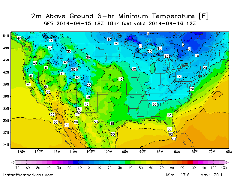
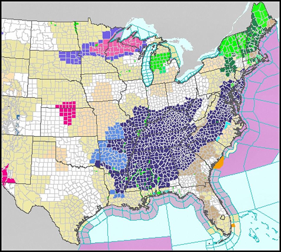
Freeze warnings are a plenty across the deep south as you can see from the map below.
The strong cold front that moved through is setting the stage for a below normal Wednesday through Friday with plenty of sun shine. But fear not as it looks like we may be in store for another fantastic weekend.
Here are the details…
Tonight…windy at times early then just breezy with near record cold. Lows should be in the upper 20s most places.
Wednesday…mostly sunny with a breezy east wind and cool with highs in the low 50s.
Wednesday night…mostly clear and cold once again with freezing temps possible. Low near 30.
Thursday…partly cloudy with a breezy east wind and cool. Highs in the mid to upper 50s.
Thursday night…high clouds and not and cold with a low in the upper 30s.
Friday…sun filtering through high clouds with a high near 60.
Friday night…mostly clear and cool with lows in the upper 30s.
Saturday…sunny and much warmer with highs in the low 70s.
Saturday night…mostly clear with a low in the mid 40s.
Sunday…partly cloudy with a high in the low 70s.
Thanks for reading and stay warm.
Jason