On Monday April 8th our low temperature was only 60.0 which broke the previous record warm low temp of 59 set back in 1948. The joys of high humidity.
Author Archives: DahWx
Dahlonega Georgia Weather Forecast Update – Saturday AM
Good Saturday morning everyone!
Spring weather is in full force as the leaves are coming out, pollen is coming out and the humidity is going up. I honestly miss the humidity right now so I personally welcome it. If your thinking of your outdoor plans this weekend, today (Saturday) will be the better day. Sunday isn’t looking terrible or anything but rain chances will be going up.
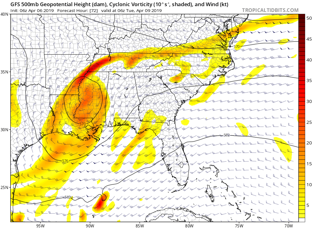
Our next weather system will be in the form of an upper level low that’s going to track across the deep south. The image I shared with this post is the expected location of that upper level low come near midnight Monday night. Upper level lows are something we see more of in the spring as the pattern transitions from winter to summer. We get these cut off systems that are generally slow movers and usually bring lots of rain and clouds.
So expect more clouds than normal, higher humidity and increasing rain and thunderstorm changes as we head into early next week. But at least it’s going to be warm.
With that in mind here are the details…
Today (Saturday)….partly to mostly cloudy with a less than 20 percent chance of a shower. High near 70.
Sunday…mostly cloudy with a 50 percent chance of an afternoon shower or thunderstorm. High in the low 70s.
Sunday night…mostly cloudy with a 60 percent chance of a shower or thunderstorm. Low near 60.
Monday through Tuesday…mostly cloudy with at least a 70 percent chance of a shower or thunderstorm. Warm and humid with highs in the low 70s and lows near 60.
Thanks for reading!
Jason
Dahlonega Weather Radar Update – Thursday 833p
Our rain is moving in for the night. Expect rain pretty much all night long. Cross your fingers everything goes as planned and the rain exits in the early AM hours on Friday leaving us with a mostly dry day.
Jason
Dahlonega Weather Radar Update Thursday 825p
Our rain is moving in for the night. Expect a rainy night tonight and cross your fingers that it exits very early Friday AM leaving us with a mostly dry Friday.

Dahlonega Weather Forecast Update – Saturday PM – *** Rain then cooler then warmer ***
Good Saturday afternoon everyone! Get out and enjoy this perfect Saturday as it’s the best day we are going to have until Wednesday. A strong cold front is headed our direction and with it will bring a round of rain starting tonight (Saturday night). The rain should be over and gone before sunrise Sunday so outdoor plans should still be intact. However we are in store for much cooler weather Sunday and Monday with another freeze on the way for Monday morning. Then we start a warming trend and remain mostly dry.
Here are the details…
Today (Saturday)…party cloudy with a high in the low 70s.
Tonight (Saturday night)…cloudy with rain likely probably starting near or before midnight. Low in the 50s.
Sunday…clearing skies early and breezy with winds gusting to 20+ mph. Chilly high in the mid to upper 50s.
Sunday night…chilly with a freeze with lows in the upper 20s to near 30.
Monday…partly cloudy with a high in the upper 50s.
Tuesday expect highs in the low 60s. Then expect highs near 70 on Wednesday and Thursday with mostly sunny conditions.
Thanks for reading!
Jason
Lousy winter…
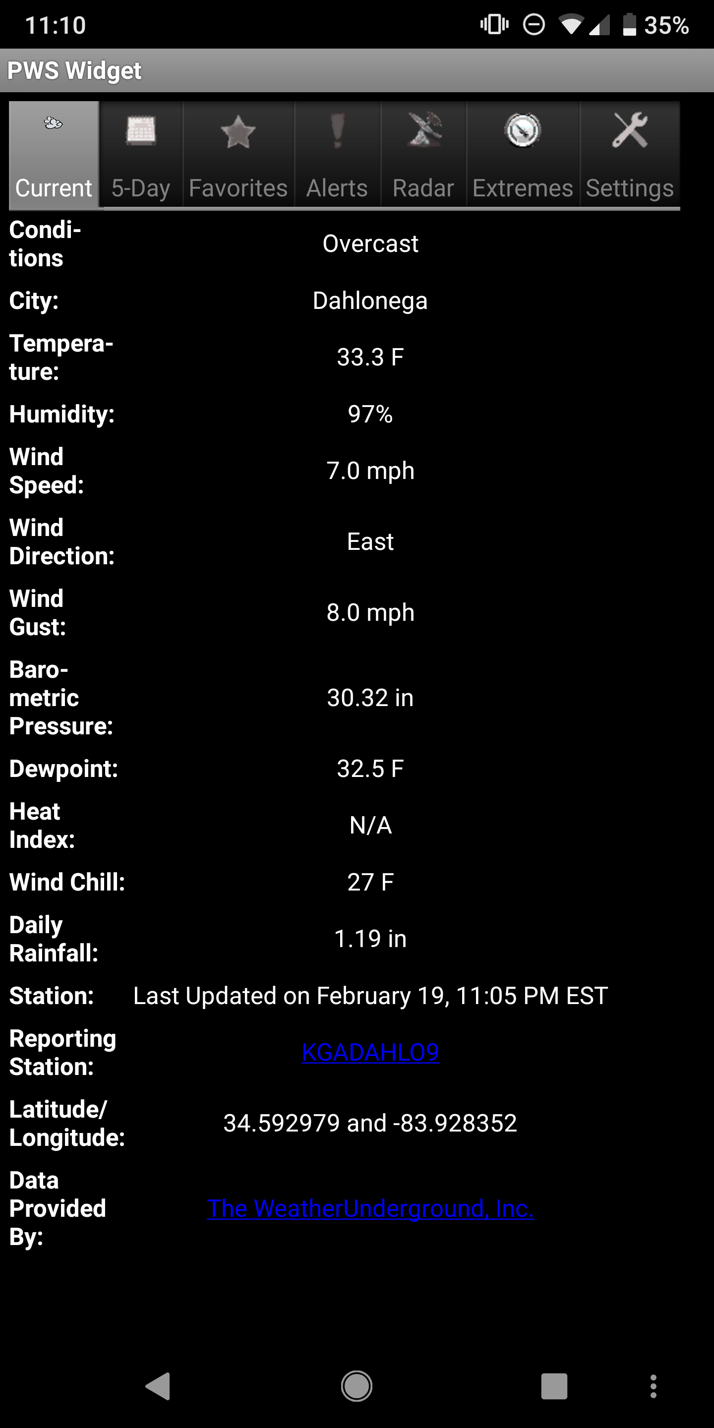
Today was our winter in a nutshell. You get a cold rain all day long. Heck even thunder and lightning. And now we sit at 33.3 with what…oh…rain. I’m done with this winter. Bring on spring.
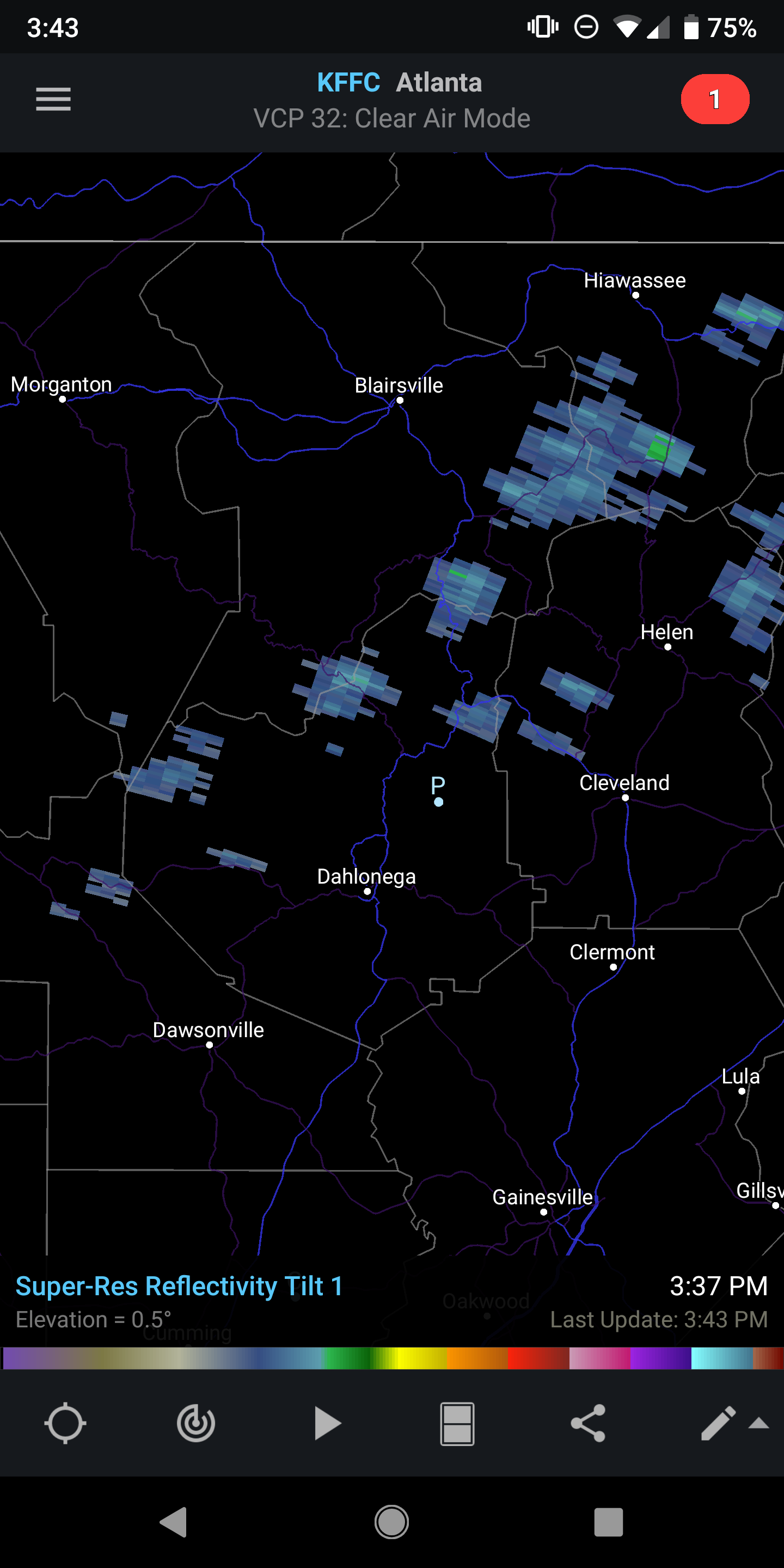
Dahlonega Weather Radar Update – Tuesday 345p
Our few scattered showers are staring to develop. They should be brief as they drift off towards the west.
Dahlonega Weather Quick Update – Tuesday 1208pm
Clouds are on the increase as will be our rain chances this afternoon. Expect scattered showers to develop as we heads towards 2pm. The showers will be scattered and will be around the area through the remainder of the afternoon. This is in response to a wedge cold front that will be arriving from the Carolinas.
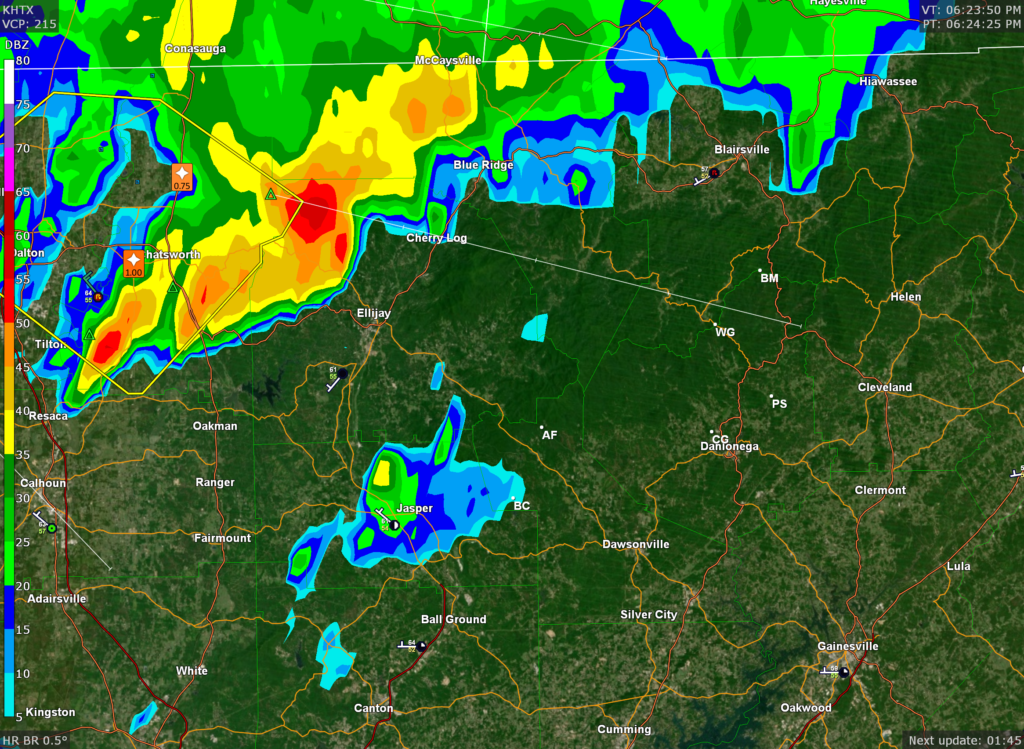
Dahlonega Weather Radar Update – Monday 627p
I heavy thunderstorm is approaching from the NW. Arrival time is probably 30 min to an hour for Lumpkin County. It has a history of producing strong winds and hail up to a quarter in size. Movement is towards the East South East.
Jason
Lousy winter…
Today was our winter in a nutshell. You get a cold rain all day long. Heck even thunder and lightning. And now we sit at 33.3 with what…oh…rain. I’m done with this winter. Bring on spring.