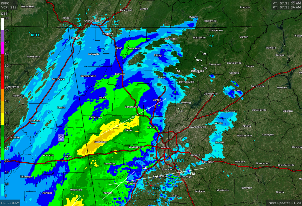
Good Tuesday morning! Winter weather rain drops are upon us and more is on the way. Our fast moving weather system has the pedal to the metal as the back edge of the meaningful precip as already exited Alabama. Rain should change over to snow in the higher elevations above 2000 feet pretty quickly. After that it’s pretty much a crap shoot on timing as the moisture will be exiting quicker than earlier expected. If we do change over to snow here in the lower elevations I’m not expecting anything more than a dusting or so on grassy areas. Also I don’t think black ice will be a problem for 95 percent of us as the sun will come out this afternoon and the winds will pick up so things should dry out. The other 5 percent is for those extremely hard to dry out places where a few icy patches could develop this evening.
FYI…all this precip across north GA on the radar is falling in the form of snow from it’s origins about 7500 feet up. It’s the lower levels that need to cool off a bit before the flakes can actually make it to the ground before melting.
Sorry…this just isn’t our system.
Jason