Good Monday afternoon everyone!
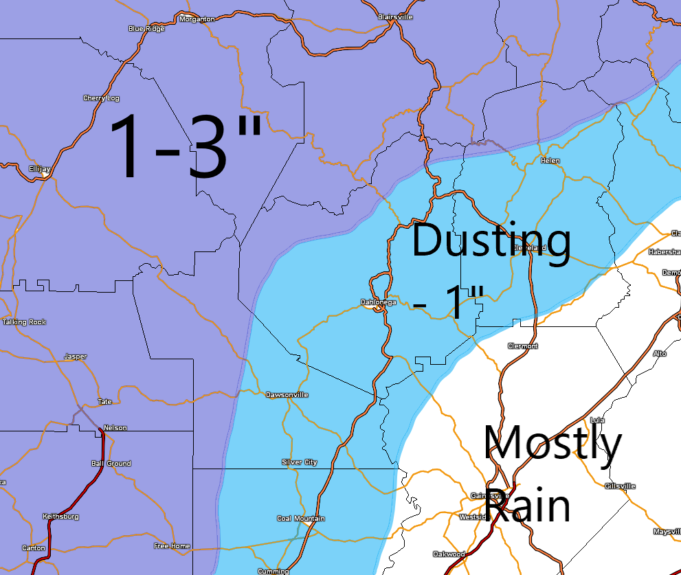
This update will be only about our snow chance on Tuesday. If your looking for the rest of the week you will need to check out my update that I posted yesterday. I’ve attached the same snowfall map to this post that I created yesterday. A few things have changed since yesterday. Pretty much all the high resolution short range guidance has all but punted with this system. The large scale global models continue to display something similar to my projected snow map. This whole deal is already razor thin on the boom or bust factor. With that in mind I think we will end up on the lower end of the range in each shaded area. What that means is closer to a dusting versus 1 inch for the bulk of us and closer to 1-2 inches versus 3 for all the areas north and west.
One trend that has happened on all the models is to be just a tad warmer at the start of the precip. That could make the transition to snow take longer and we are already in a tight window of moisture opportunity. Truthfully I have to basically throw out the high res short range models completely in order for me to believe may snowfall map is even possible. I’ve seen some pretty big busts over the years and this has the potential to be one of those. And we are now under an official winter storm warning and schools have been cancelled. Ugg….
Also people have been asking me able black ice and I just don’t think that’s going to be an issue for 95 percent of us due to winds and afternoon sunshine. But those isolated shady spots could develop some ice by Tuesday night.
Here is the timing as I see it now. Rain starts in the form of drizzle and showers after midnight. By sunrise the band of moisture should be knocking on the door with our temps in the low 40s. Yep 40s. Rain should transition to snow between 9-10a and last until maybe noon. And that’s it. Accumulation will be difficult due to above freezing temps…unless your in the darker shaded areas.
Now remember…this is based on me completely ignoring pretty much all the short range models and that’s a scary thought personally. We shall see….
Now it’s basically just watch the radar out in Arkansas and Mississippi as the precip breaks out and slides east.
Jason