Good Saturday morning everyone!
So far everything has progressed as expected. We are in the midst of our chilly cold rain day so enjoy that. Yes we are now under a winter storm warning per the National Weather Service out of Peachtree City. If you carefully read the warning text you see they mostly reference places above 2500 getting the best accumulation which aligns with my thinking all along.
Brand now model guidance is hot off the press and not a whole lot has changed. I do believe the chance of seeing more widespread snow tonight has increased…just a tad. It still looks decent for places above 2000 feet and along and north of the spine of the apps. Places like Suches should end up with probably 2-4 inches.
Here is how I think things will progress.
Today will feature mostly just a cold rain that’s heavy at times. During the heavier periods of rain I would not be surprised if some snow flakes mix in all around the area. As we progress through the night our best chance to see widespread snow will be in the window from around 10p-2a as the upper levels just might be good enough to allow the precip to change over. Again this is for all areas of Dahlonega. Higher elevations should get accumulating snow as I described in the paragraph above. Snow or not for the majority of us there should be a period of sleet and or freezing rain lasting until mid Sunday morning. Now if the precip ends up being more sleet then roads could be an issue. If it ends up more freezing rain then personally I think they will be just wet.
Sunday will continue the mix bag precip as showers could mix with or change to snow at times with no accumulation expected below 2000 feet elevation. Oh and if you want to know your elevation, just download a gps status app on your phone and it will tell you.
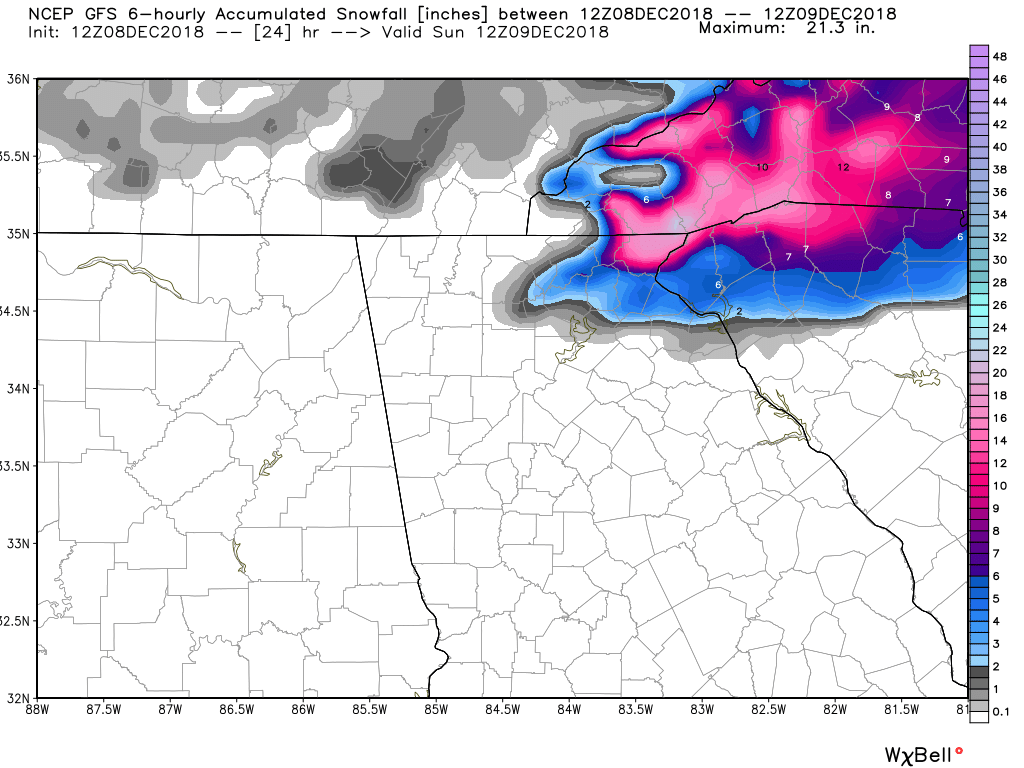
The mixed bag precip will continue into Sunday night before everything finally exits on Monday. Now what I laid out is what I think is the most likely scenario to happen. Theres always potential for this to over perform. The latest GFS snow map displays what I think this could look like IF IF IF IF IF IF IF IF IF IF IF IF IF IF it over performs and the system dynamics win out over the marginal upper level temps.
Also something that is useful is to download the mPing app on your phone and report your current conditions from time to time should the weather your experiencing change. It’s a cool and free app and you can see where it’s raining and or snowing based on ground reports.
Thanks for reading!
Jason