Good Friday evening everyone!
Today was a precursor to what a majority of our weekend will be like…chilly and wet. An area of low pressure will slide across the Gulf Coast this weekend while high pressure noses down the eastern slopes of the Apps locking in a wedge pattern which spells mostly just chilly and wet. I say mostly because we are likely to see a little bit of everything and a LOT OF RAIN.
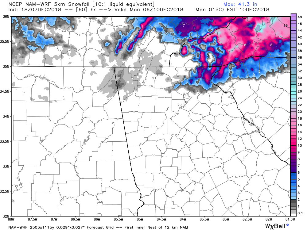
Yes I know we are under a Winter Storm Watch but I’m not as enthusiastic as the weather service is regarding snow totals. I posted a long update yesterday and explained what I thought would happen as well as possibilities of what could happen. Since that post we’ve gone through 4 more cycles of updated computer model guidance. After digesting all the data and looking at all the various models I don’t feel inclined to alter the forecast a whole lot. I know there are plenty of very ambitious fantasy snow maps of which I’m am constantly shaking my head so please don’t believe most of those. The snow map I posted below is the latest projected amounts by a higher resolution short range model. Personally when I see this I think it better represents what is possible in north GA. As I stated yesterday the upper levels are going to be so marginal to support winter precip and snow and just a few degrees colder change from the surface to 10k feet up would make a huge difference. But I have not seen any trends towards that direction. Could that still change…yes. But so far it hasn’t.
So here is my best take on what I think is most likely to happen.
Saturday…cold rain with temps in the 30s.
Saturday night…cold rain changing to most likely sleet and or freezing rain after midnight. If its more sleet than driving conditions will be worse. If it’s more freezing rain just elevated surfaces like bridges and overpasses will be a concern. There could also be some snow mixed in especially areas above 2000 feet. It’s going to be windy also with gusts to near 30 mph.
Sunday…mixed bag precip changing back over to rain or rain snow mix. Best snow chance is above 2000 feet especially areas along and north of the spine of the apps.
Sunday into Monday…rain or rain snow or snow showers persist. It’s that marginal so it’s next to impossible to say exactly what it will be. High elevations will be more snow for sure.
I’m expecting 1-3 inches of snow above 2000 feet in elevation with dusting to just token flakes falling from the sky for everyone else.
So there you have it. Things can still trend for more winter precip. so I’ll be still watching everything closely.
Thanks for reading!
Jason