Good Thursday afternoon everyone!
My oh my what a difficult forecast we have in store. Needless to say there is a lot of hype around this early season weather system on the way this weekend. Unfortunately with it being so early in the winter, frozen precip conditions are not as strong which just adds to the difficulty in nailing down any sort of forecast. We have all things in store of us and so to try and simplify this I’ll just break out each part on it’s own.
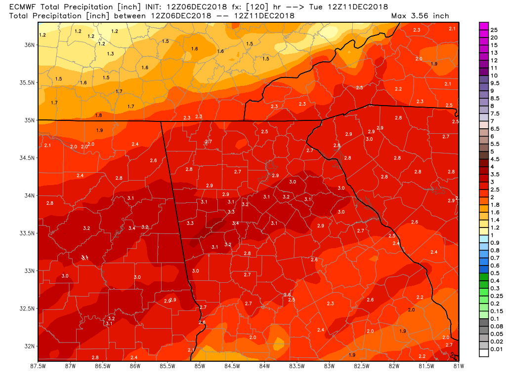
Rain – Lots of liquid precip is on the way. Starting early Saturday the rain will move in and will be heavy at times. Expect 2-3 inches to be the common theme as you can see by just the Euro models expected precip. Pretty much all computer guidance suggests the same thing regarding rain amounts.
Freezing Rain and Sleet – towards sunrise Sunday morning the upper levels will start to cool off dramatically which will likely give us a period of sleet and or freezing rain lasting into the late AM hours. Amounts are up in the air and likely impacts are the normal elevated surfaces and bridges. If it’s more sleet (which it could be) then all the roads could become an issue. If it’s just freezing rain then impacts should be much less as asphalt should be just wet.
Snow – As the system moves off to our east, wrap around moisture will return across the area Sunday night into parts of Monday. By then the upper levels should be able to support snow falling. But surface temps will likely be above freezing at that time so the flakes will likely be more of a novelty than impactful…unless….you live above 2000 feet and all places along and north of the spine of the Apps. I would expect 1-2 inches in those locations. Places like Suches to Blairsville, etc.
Wind – Saturday night will be come quite windy as the pressure gradient between the low tracking along the Gulf and high pressure up in the NE tightens. Expect gusts over 30mph out of the east. Yep…east wind wedge.
Temps – Just chilly with highs in the 30s Saturday and Sunday and probably Monday too.
So a quick recap of the best thinking at this time. Rain moves in Saturday morning and lasts all day and into Saturday night. Early Sunday morning rain likely transitions to freezing rain or sleet or both lasting until late AM hours Sunday. Then Sunday afternoon is just spotty showers persist. Sunday night into Monday moisture returns in the form of snow or rain/snow mix lasting through the first half of Monday.
Bust potential….There is so much bust potential in either direction with this system. Just a 3-4 degree swing in the temperature column between the surface and 10,000 feet up could completely change the game big time. Colder obviously means more winter precip. Needless I’m wasting way too many hours looking at model guidance runs. Even though I’m not posting very often I’m all over this system. Oh and please don’t get caught up in all those crazy snow maps that keep popping up on the internet. There are no many flaws with those maps and how they are produced I don’t have time to go into all that right now. LOL.
Thanks for reading and updates will continue as needed.
Jason