Good evening everyone. We are on the verge of a potentially power weather system in the form of now current hurricane Irma that will be tropical storm Irma when is crosses southern Georgia.
The affects are already starting to be felt as the pressure gradient between Irma (which sits SW of Orlando as of 1147pm Sunday) and high pressure to our Northeast is starting to build increasing our wind gusts out of the east. This will only increase as we head through the night tonight and into tomorrow.
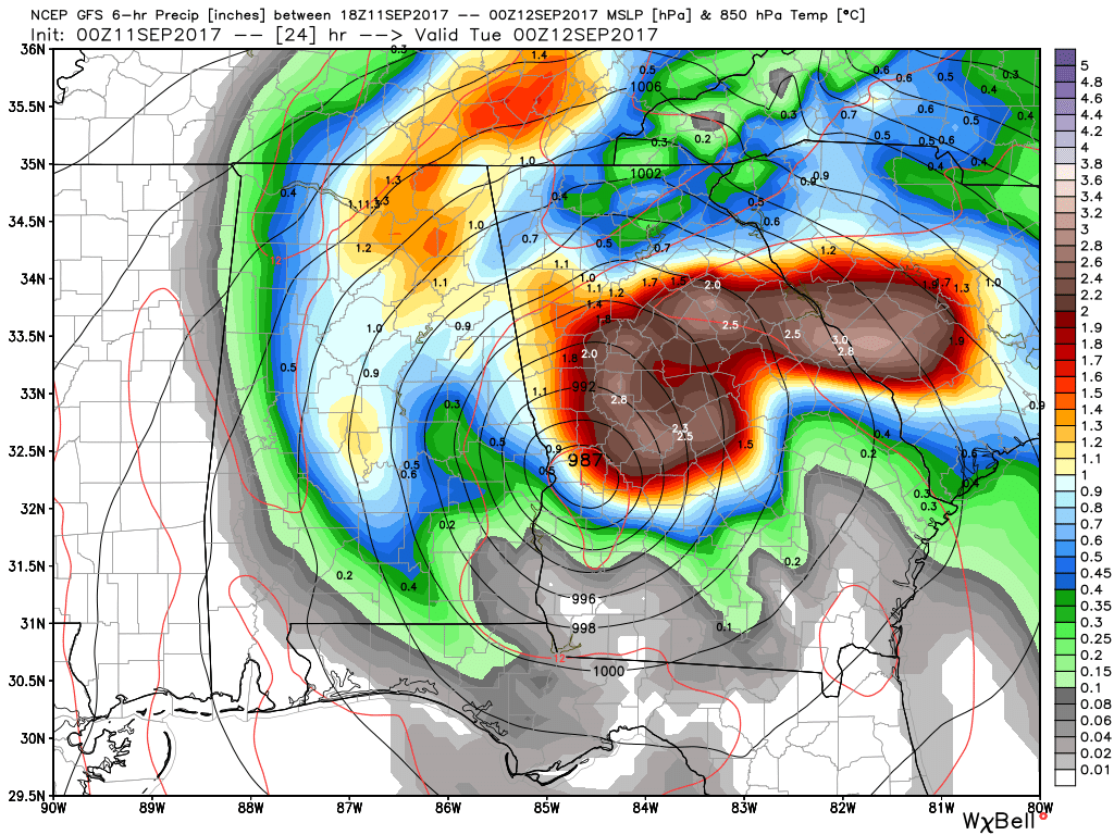
Even though Irma is tracking further west than previously thought, my forecast remains unchanged. Rain should arrive before sunrise Monday and last on and off all day long and get heavy at times especially during the afternoon and evening hours. With the heavier bands of rain will come the highest winds because just about 4,500 feet up the wind will be screaming at 80+ mph. The heavier bands will tap into these winds and give us our highest gusts which I’m expecting to top 50+ mph at times. The best potential for the highest winds should be in the later afternoon hours and maxing out near or shortly after sunset Monday.
Also since we are now firmly on the northeast side of the track of Irma, we will need to monitor for potential quick spin up tornadoes. That is always a threat with land falling tropical systems and is currently happening across portions of eastern FL.
So a quick recap is expect:
– strong and gusty winds to 50+ mph with highest winds late afternoon into early Monday night.
– heavy rain amounting to 2-4 inches
– good potential for power outages due to falling trees.
– isolated threat of a tornado.
Thanks for reading and updates will be flowing as usual.
Jason
Thanks for the update
Thanks for keeping us up on this.
Thank you!!!
Thanks Jason!
Thank you for the current update!
Thank you for all of your hard work in keeping us informed.
Thank you, Jason! I always feel much better informed (on how the weather will be in OUR area!) after reading your posts.
Thank you !
Krystal Youngblood Cameron Youngblood
Thank you!!
Thanks Jason!
Irmagedon
Michele Kuhs
Thank you Jason for keeping us informed on the weather conditions.
Thank you
Thank you!!!
Stay safe!
Thanks for info
Dean Rasnick
Thank you Jason!
Thank you Jason
Thank you Jason!!
Thank you
FatMak Wright
Thank you for update
Thanks for the update..
Thanks Jason, appreciate the help! Stay safe
Thank you
Thank you for the updates for our area!
James Dowdy
My fave weather site
Praying for your area & the safety of everyone.
You nailed it!! 🙂
Thanks. Truthfully I was hoping the whole thing would bust. Lol